Description
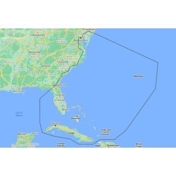
C-MAP® REVEAL™ Coastal charts deliver the pinnacle of marine cartography, whether you’re cruising, fishing, or sailing. These charts combine the innovative Shaded Relief and Reveal Seafloor Imagery with essential features from DISCOVER™, such as full-featured Vector Charts, Custom Depth Shading, Tides & Currents, and subscription-free Easy Routing™. With added enhancements like Aerial Photography, Satellite Overlay, and Dynamic Raster Chart presentation, C-MAP REVEAL™ Coastal charts provide unparalleled detail and accuracy. Compatible with Lowrance, Simrad, and B&G Chartplotters.
Key Features
-
Shaded Relief
Bring your surroundings to life with 3D-rendered land and underwater elevations, including areas of Ultra-High-Res Bathy seafloor imagery – a transformative tool for anglers. -
Full-Featured Vector Charts
Navigate effortlessly with accurate, up-to-date vector chart details derived from official Hydrographic Office data. -
High-Resolution Bathymetry
Identify critical underwater features like shallow areas, drop-offs, ledges, and holes, now with compiled and quality-controlled Genesis® data in a single HRB layer. -
Custom Depth Shading
Set a clear safety depth, maintain a paper-like view, or create custom shading tailored to your needs. -
Dynamic Raster Charts
Enjoy a traditional chart look with easy access to all navigational objects. -
Easy Routing™
Automatically plot the safest and shortest route based on detailed chart data and your personalized vessel information, without a subscription. -
Aerial Photography
Access thousands of photos of marinas, harbors, inlets, and other key navigational features for an additional level of detail. -
Satellite Overlay
Gain a better understanding of your surroundings with satellite imagery, especially in unfamiliar areas. -
Tides & Currents
View projections of water levels and tidal directions to plan your outings with precision. -
Detailed Marina Port Plans
Dock confidently in unfamiliar ports with precise layouts of marinas, including slip spaces and restricted areas. -
Harbor & Approach Details
Approach any harbor or inlet with the highest level of detail, perfect for concluding a long voyage, sailing adventure, or day of fishing.
No specifications available.
Related products
-
OEM: A015800Request a Quote
-
OEM: A018200Request a Quote